
Walk a Leesburg Street Record
A reliable Leesburg street directory search moves from the address point to the parcel and then to records tied to that parcel. Ownership is public, but ownership and occupancy are not the same fact. The Lake County Property Appraiser supplies the current owner, situs address, mailing line, parcel number, alternate key, legal description, sales, values, and improvements. County GIS then lets a reader inspect nearby parcel shapes. Deeds, permits, lawful voter data, and old directories add separate evidence.
Keep the address exactly as each office shows it. Unit numbers, road suffixes, subdivision names, and the alternate key prevent similar properties from being merged. Follow these steps:
- Normalize the full address in city GIS, including unit, ZIP, postal city, and jurisdiction city.
- Search the Lake County Property Appraiser and save the parcel and alternate key.
- Open the Lake County Interactive Map and inspect parcels beside it.
- Follow the current deed citation into the clerk index, matching the legal description.
- Add permit, voter-file, and old directory evidence for the date being researched.
This street-by-street process separates a named owner from other possible occupants. That distinction is the key to an honest result.
Search Leesburg Property by Address
The Property Appraiser is the best first stop for a present-day street directory. An address query locates physical property, while an owner-name query can lead to one or more parcels. A parcel number is the formal identifier. The alternate key is Lake County's shorter parcel key. Partial name variants can help, but each hit must be checked against the location.
| Search choice | Input | Street use |
|---|---|---|
| Owner Name | Last then first, no comma | Find parcels tied to a known owner |
| Address | House number and street | Resolve the situs property |
| Alternate Key | Numeric county key | Move between county systems |
| Parcel Number | Formal parcel ID | Confirm exact land identity |
| Subdivision | Name or autocomplete | Group lots within a plat |
Results can show ownership and mailing details, land and building facts, exemptions, sale history, and a legal description. They do not list every person in the home. The roll is updated nightly, yet county sale-map data may lag a sale by about one month.
The official property search screen shows the address-first gateway.
Leesburg Street Directory Terms
County and clerk records use land terms more exact than a mailing label. Four terms make the Leesburg street directory much easier to read.
- Parcel
- A mapped unit of land with a county identifier.
- Situs address
- The physical tax-roll location, which may differ from an owner's mailing address.
- Plat
- A recorded map dividing a subdivision into lots and blocks.
- Criss-cross directory
- A directory arranged by street and house number rather than only by surname.
The legal description and parcel key survive changes that can make a street name unreliable. Use them when an old address does not match a modern search.
Browse Leesburg Parcels Along Streets
County GIS changes one address into a block view. Search by owner, address, alternate key, parcel, or subdivision, then zoom until outlines are clear. Click parcels one by one or draw a rectangle. “Add to selection” keeps noncontiguous parcels, while “Buffer Selection” expands from a chosen parcel. Linked details may include owner, situs, mailing address, sale data, year built, values, land use, and links to taxes and permits.
Map boundaries are for visualization, not surveys, and easements are not shown. Confirm a critical line in a recorded plat or land record. GIS is still the best way to browse owners along a Leesburg street without claiming that parcel adjacency proves who lives together.
View the Leesburg address-layer fields, including FullAddress, unit, ZIP, PostalCity, JurisdictionCity, lot, alternate key, and status.
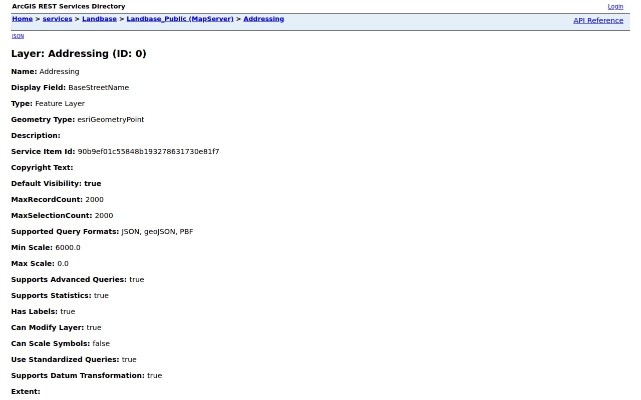
The layer explains why a Leesburg postal label can differ from government jurisdiction.
Leesburg Records Keyed by Street
No single roll is a full street directory. Strong results join sources while preserving their limits. Web access is free for property and mapping. Clerk images vary, voter street data requires the custodian channel, and older directories may require the library.
| Address record | Keeper | Evidence | Access |
|---|---|---|---|
| Property roll | Property Appraiser | Owner, situs, mailing, parcel | Free portal and bulk data |
| Parcel GIS | Lake County GIS | Shapes, sales, linked facts | Free map |
| Deeds and plats | Lake County Clerk | Transfers and legal identity | Web, terminals, books, microfilm |
| Permits | City of Leesburg | Work, applicant, date, status | Guest search or account |
| Voter file | Elections office | Nonprotected registrants | Defined records request |
| Directories | Leesburg library | Occupant in a publication year | Digital, shelf, affiliate terminal |
A parcel owner is not proof of a full household. Registration can lag a move, permits may name contractors, and directories can omit people.
Leesburg Permits Date Address Changes
The Leesburg permitting portal ties work to an address and date. Guest quick access is meant for one permit. An account supports broader functions. The tutorial describes an owner route that asks for account type and address; the lookup uses a house number plus the first letters of the street. Results may connect a parcel with an owner or applicant, contractor, permit type, status, and inspection trail.
Permits explain when a structure changed, but they do not prove that an applicant lived there. If online coverage stops, send the city clerk a narrow Chapter 119 request with address, record type, approximate dates, and preferred format.
The portal bridges a parcel record to dated building activity at the address.
Turn Leesburg Parcels Into Deeds
Start with the deed citation on the parcel card. In the Lake County Official Records index, note the grantor, grantee, recording date, instrument number or book and page, and exact legal description. A grantor transfers an interest; a grantee receives it. Find the prior deed in which the current seller appeared as buyer, then repeat.
The index supports party name, clerk file number, book/page, document type, and recording-date range. Online Official Records begin in 1957. Deed books run from August 5, 1887 through 1956, and plats reach October 11, 1884. The Tavares research room provides books, microfilm, and digital images reaching 1887. Staff explain equipment but cannot do title searches. FamilySearch catalogs six grantor and grantee index reels for 1887 through 1927; images may need an affiliate library terminal.
The chain identifies owners, not every resident. That is the core myth to avoid in a street directory search.
Postal Leesburg Is Not Jurisdiction
A “Leesburg, FL” mailing line does not prove a parcel lies inside the city. GIS stores PostalCity and JurisdictionCity separately. Planning layers change as annexations pass. Street centerlines can carry separate left and right ZIP and corporate-limit fields. The right permit or code office depends on jurisdiction, not the postal label.
Leesburg planning layers include annexation, zoning history, historic preservation, and planned developments.
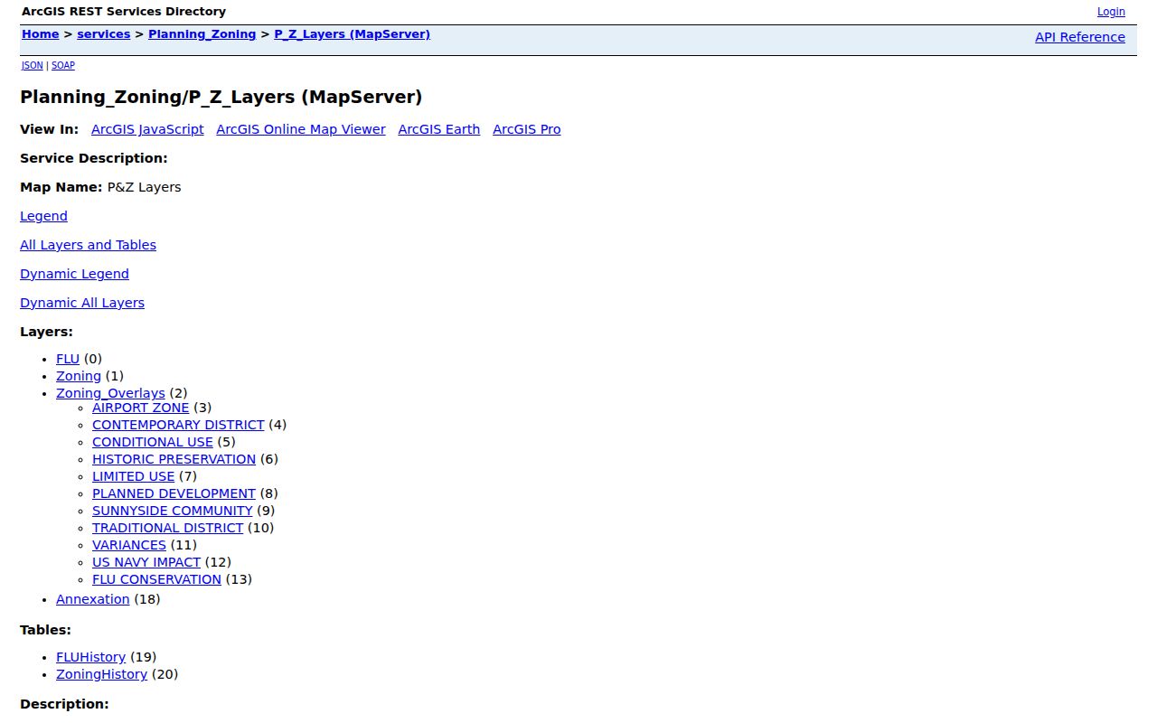
The official layer source helps resolve conflicts between postal identity and city jurisdiction.
Note: No verified source gives one citywide renumbering year, so bridge old addresses with plats, maps, directories, and annexation records.
Leesburg Voter Data by Street
The personal Lake County voter lookup is not street browse. It requires first and last name, date of birth, agreement, and CAPTCHA; house number may resolve a multiple match. It is meant for a voter to check status, precinct, ballot, polling information, vote-by-mail status, and recent participation.
A lawful street file comes from the Supervisor of Elections through a defined request. Specify Leesburg geography, fields, format, snapshot date, and use. Ask for a data dictionary, estimate, and protected-field suppression. Florida law withholds Social Security and driver-license numbers, registration-location data, preregistrant data, and signature copying. Protected voters get more safeguards. Registration supports a residence finding, but does not prove current occupancy.
Read Older Leesburg Streets in Reverse
A reverse or criss-cross section lists streets, house numbers, and the household name printed for a year. Coverage must be checked volume by volume. Leesburg Digital Collections includes directories, newspapers, maps, yearbooks, oral histories, Project Collect, and service records. Library affiliate terminals can open some FamilySearch images locked at home.
Use directories for occupants and deeds for owners. Census schedules, obituaries, and permits can fill years between editions. The Leesburg city directory collections cover the historical shelf in depth; this address use stays focused on one street section.
Limits of Leesburg Street Records
Parcel records do not list all renters, relatives, guests, or household members. Voter files omit nonvoters and suppress protected people. Utility customer data and DMV addresses are not public resident rolls. GIS measures land, not social ties. A missing name may reflect a move, publication gap, protected address, or source limit rather than a firm conclusion.
Commercial directory tools can merge stale records and same-name people. Use official custodians, note each result date, and require two independent matches before connecting a name to an address. Dates matter as much as names. A deed proves a transfer on its stated date, a tax roll describes one assessment cycle, and a printed directory describes the publisher's canvass. None should be silently treated as a live household list.
Lawful use. Use Leesburg address records only for personal, lawful research. Never use an address trail to stalk, harass, threaten, or expose a protected person.
Where the web stops, contact the correct custodian. The Clerk research room is at 550 W. Main Street in Tavares. The Records Storage Facility at 313 S. Bloxham Avenue holds inactive county material. City Clerk requests should name the address, record type, date range, and format.
The Clerk's research room is a distinct access channel, not just a replacement for a broken website. Its books, microfilm, and digital media can answer questions that the public interface cannot. For a planned visit, carry the parcel key, exact legal description, party names, and a narrow year range. Staff can point to equipment and record groups, but the researcher must perform the chain. When a county record has moved out of active storage, call the Records Storage Facility before traveling so staff can arrange retrieval from more than 15,000 boxes.
The city clerk is the better route for municipal permits, annexations, easements, vacates, commission records, and developer agreements. Florida Public Records Law does not require a requester to explain a purpose. A clear request still saves time: state the exact address or name spelling, record class, likely date span, and whether an electronic or paper copy is preferred. Deeds, court files, and plats remain county clerk matters. Sending each request to the actual custodian prevents delay and keeps the Leesburg street directory trail tied to its source.