
Four Leesburg ZIP Identities at a Glance
The Leesburg ZIP code directory begins with two standard delivery areas and two post-office-box identities. A standard ZIP can cover streets and parcels across a broad delivery area. A box-only ZIP routes mail to a postal facility and should not be drawn as a neighborhood. Official records may index the same place by parcel, street, owner, or jurisdiction instead.
| ZIP | Local identity | Post office | Reading note |
|---|---|---|---|
| 34748 | Downtown, City Hall, Venetian Gardens, west and south Leesburg, plus a broader delivery area | Leesburg Post Office, 1201 S. 14th Street | Standard delivery; extends beyond city limits |
| 34788 | Northeast Leesburg, Haines Creek, Silver Lake and Lisbon vicinity, plus county territory | Haines Creek Post Office, 32327 County Road 473 | Standard delivery; includes much unincorporated land |
| 34749 | Leesburg box-mail identity | Leesburg postal facilities | PO-box-only, not parcel geography |
| 34789 | Leesburg box-mail identity | Leesburg postal facilities | PO-box-only; verify current assignment |
Confirm the mailing form with the USPS ZIP Code Lookup. Use local GIS or the tax roll when the question concerns land, ownership, or city jurisdiction.
Why Leesburg ZIP 34748 Exceeds the City
Downtown and many familiar city places use 34748, but its delivery reach does not stop at the corporate line. A mailing address can correctly say Leesburg while the parcel remains outside municipal Leesburg. Records held by the city and county can therefore answer different questions about one address.
For delivery, use USPS. For city status, inspect JurisdictionCity and the current boundary or annexation layer. For tax ownership, use the Lake County Property Appraiser. This three-way check keeps postal, governmental, and property identities from collapsing into one label.
Myth check. A Leesburg mailing line proves postal routing, but it does not prove that an address lies inside the city.
Leesburg ZIP Code 34788 and Haines Creek
The northeastern postal area has a dual Leesburg and Haines Creek identity. It includes Silver Lake and the Lisbon vicinity as well as substantial county territory. The Haines Creek Post Office is the local facility named in the research. That mix makes 34788 a strong example of why a ZIP result needs a jurisdiction check.
A property may share postal Leesburg with city parcels while receiving county treatment for other records. The city address service stores PostalCity and JurisdictionCity as separate fields. Researchers should carry both into their notes instead of choosing the name that looks most familiar.
Box ZIP Codes Are Not Leesburg Neighborhoods
ZIPs 34749 and 34789 are box-mail identities. They can appear in correspondence or owner mailing data, yet they do not describe a street-delivery zone that can be walked parcel by parcel. Treating either as a neighborhood would create a false map and could connect unrelated people who merely use the same postal facility.
The situs line on a property record identifies the physical parcel; the mailing line tells where tax correspondence goes. An owner may receive mail at a Leesburg box while the land is elsewhere. A box ZIP is a useful filing clue, but it is not proof of residence, ownership location, or municipal status.
Find Leesburg Residents Within One ZIP
A ZIP can reduce a broad name search, but no basic local portal promises a complete list of everyone in that area. The sound method combines postal verification, GIS fields, and record-specific searches. Move from the broad delivery clue to exact addresses, then validate names in the source that created them.
- Confirm the address and delivery code through USPS.
- Compare ZIPCODE, PostalCity, JurisdictionCity, unit, alternate key, and status in the city address layer.
- Use the alternate key or street address in county parcel tools to identify the tax parcel and owner record.
- For area-wide work, use published tax-roll or GIS downloads, or a narrow records request, rather than assuming a quick-search box enumerates the ZIP.
- Once a street is known, follow the Leesburg street directory for address-level work.
This workflow keeps a Leesburg ZIP code directory focused on geographic narrowing. It does not turn a delivery code into a resident census, and it preserves the difference between owner, voter, and occupant.
Leesburg Address Fields Behind ZIP Results
The city ArcGIS address layer bridges a postal result and an official address. Its schema can distinguish records that look alike in a casual search. It also marks an address active, inactive, or proposed, which helps explain why a new or changed location may not appear everywhere yet.
| Field | What it adds | Why it matters |
|---|---|---|
| FullAddress and unit | Normalized location | Separates units |
| ZIPCODE | Postal code on the feature | Supports data queries |
| PostalCity | Mailing city | Can say Leesburg outside the city |
| JurisdictionCity | Municipal authority | Answers the city-limit question |
| Alternate key and lot | Parcel bridge | Connects tax and land records |
| Status | Address lifecycle | Flags proposed or inactive points |
Consult the Leesburg public address layer before drawing conclusions from a ZIP alone.
Two Sides of a Leesburg Street Can Differ
Local street-centerline data stores left and right ZIP values, address ranges, and corporate-limit indicators. On a boundary road, one side can carry a different postal or governmental value from the other. Searching only a street name can therefore mix parcels that do not share the same context.
Use the full house number and side of the road, then compare the point address with centerline fields. This is stronger than drawing a boundary from a ZIP list, especially near annexed land, planned development, canals, and the irregular road network around the lakes.
Leesburg ZIP Code Boundaries Versus City Limits
Postal routes deliver mail. City limits define municipal government. Parcel boundaries define land. These systems overlap without being interchangeable. Annexation layers change as the commission updates corporate limits, so a historical record and the current map may truthfully assign different governmental contexts to one place.
- ZIP code
- A five-digit USPS delivery area or postal identity.
- ZIP+4
- A more precise delivery segment, often tied to a block, building, or box group.
- PO-box ZIP
- A postal identity for box mail rather than street parcels.
- Unique ZIP
- A code assigned to one high-volume organization; none was verified for Leesburg.
- Carrier route
- A delivery path within a ZIP, not a city district or resident roll.
The Leesburg planning service supplies annexation context. Record the map date when city status matters.
Property-Roll Limits in the Leesburg ZIP Code Directory
The county property record shows an owner and tax-mail destination, not every resident. Owner and occupant are not equivalents, and the research shows that a notable share of occupied Leesburg units are not owner occupied. A parcel result can anchor land identity without naming all people who live there.
The Property Appraiser quick search emphasizes owner name, address, alternate key, parcel number, and subdivision. It does not promise a simple consumer ZIP browse. Current county guidance points area researchers toward published tax-roll and GIS downloads rather than custom data work. Use those sources for a narrow lawful purpose, and verify results at parcel level.
Fast Leesburg Growth Calls for Current ZIP Checks
Leesburg grew sharply between the 2020 count and the July 2025 estimate, while its land area had already expanded between 2010 and 2020. Growth, development, and annexation make old assumptions fragile. A recent street may be proposed in one dataset, active in another, or in a postal area whose familiar name hides county jurisdiction.
Use current USPS data for delivery, live city layers for municipal context, and the nightly updated parcel record for land identity. Save the date of each check. That habit makes the ZIP code directory useful after a new annexation, parcel split, or address activation.
The captured USPS source shows the official delivery-verification starting point.
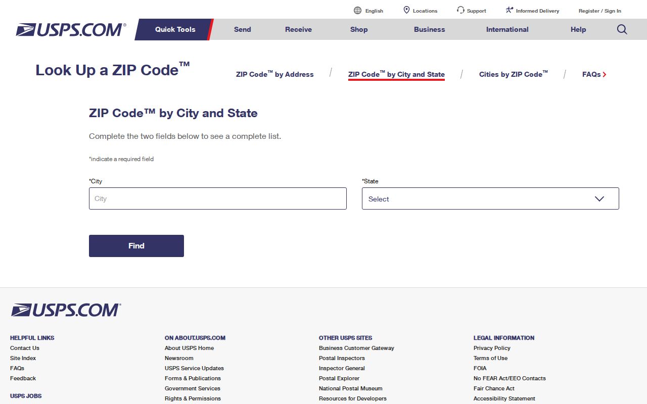
Carry its postal answer to local GIS before making any city or parcel claim.